Mumbai is the sixth most densely populated metropolitan region globally, with its urban population continuing to expand. The nation grapples with the challenges posed by climate change amid its economic progress. Rapid urbanization puts immense pressure on the environment. To address this, the country drafted the Mumbai Metropolitan Region Plan (MMRP) 2016-26. This plan describes some crucial points like population growth trends, housing needs, environmental status, and the city’s challenges due to rapid urbanization.
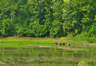
Rapid urbanization impacts the environment with increased emissions and leads to failures in the sanitation system, management of solid waste, and clean water issues. The plan shows that 32% of land is urbanized, and 68% consists of forests, mangroves, mudflats, and intertidal zones. The vast majority of people who migrate here settle around bodies of water. The migrant community includes farming, fishing, and tribal people. As a result, these natural resources are under pressure.
From the scarcity of infrastructure, the community faces issues like proper sanitation systems, which later lead to untreated sewage, wastewater, and solid waste, polluting the groundwater table. The municipality struggles to provide proper infrastructural systems to the new townships. In some cases, they focus on existing bodies of water and build concrete edges with walkways and manicured gardens in the name of beautification.
The Society for Promotion of Area Resource Center (SPARC), funded by the Adaptation Fund Climate Innovation Accelerator (AFCIA), Adaptation Fund, and the European Union, proposes to design a passive decentralized wastewater, sewage, and solid-waste system managed by the inhabitants of the villages of Mumbai city and to integrate them with the surrounding ecosystem. SPARC, with the help of community-based organizations, has strengthened the community’s capacity and made a plan to treat the wastewater and sewage that would receive primary anaerobic treatment through reed beds. Reed beds provide a natural filtration system that can treat and improve water quality before it is discharged into the environment. The villagers can then use the nutrient-rich water in the surrounding lake for their agricultural fields.
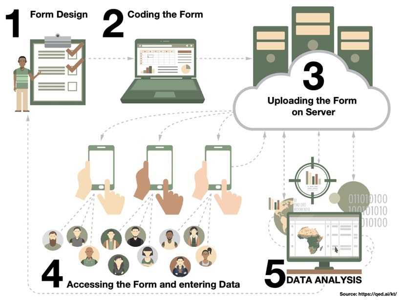
Technologies used in proper documentation.
The study team’s digital technology approach centers on utilizing Free and Open Source Software (FOSS) to enable any community-based organization worldwide to replicate the process for similar projects without incurring expenses. They used two open-source applications to collect the data, Open Data Kit and Mapillary. With ODK Collect (an Android app) the team gathered attributes, including name, ownership, pollution details, pollution causes, current use, coordinates (Latitude-Longitude), and photos.
The team employed a mobile crowdsourced street viewing platform, Mapillary, to capture selected water bodies’ surroundings and physical context, primarily focusing on the water body’s edge condition. Mapillary generates GPS tracks (movement paths) and photo locations, which can be viewed on the Mapillary website and in the QGIS desktop interface.
“The team initially created a database of inland bodies of water using MMRDA maps and two layers of data from Mapbox Satellite Imagery and Google Earth Engine (GEE)”
Challenges in implementing ideas on the ground
The team initially created a database of inland bodies of water using MMRDA maps and two layers of data from Mapbox Satellite Imagery and Google Earth Engine (GEE). This combination revealed 689 additional bodies of water on top of the 2190 identified by MMRDA. However, this method, while powerful, is only partially reliable. Subsequently, during ground truthing, the team discovered more bodies of water hidden by thick vegetation that could not be located through satellite analysis.
The research team faced several obstacles when trying to reach bodies of water that lacked proper road infrastructure. Additionally, the monsoon season posed difficulties in accessing certain bodies of water. There were instances where the team encountered hostility from private water body owners. However, since the primary focus of this project is on public water bodies, this was not a major concern for the research team.
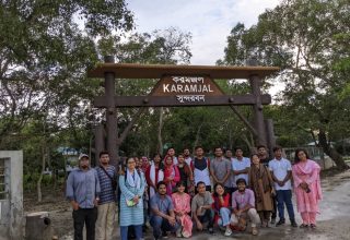
After remote mapping, the team engaged with local community members and organizations in various talukas known as sub-districts of Mumbai city. They explained the project’s purpose and requested assistance in ground-truthing these bodies of water. While some communities understood and agreed to help, others were not interested in projects focused solely on their own bodies of water. Convincing them to contribute to the broader region’s well-being and climate change mitigation was challenging.
In Bhawandi Taluka, local community leaders were highly supportive and pledged to assist the study team in securing government funds once detailed implementation plans for the bodies of water were developed.
Research Findings
The study team found densely populated, economically disadvantaged settlements extending to the water’s edge, with narrow alleys, lack wastewater management and contribute to water pollution from kitchens, baths, toilets, and solid waste.
Settlements that were separated from the water’s edge by a road or pathway had a different relationship with the water. Typically, these settlements did not appear to pollute the waterbody with liquid or solid waste and have access to a centralized sewage system.
Bodies of water that have a hard edge, with a landscaped public space around it, and are separated from the settlement by a road still have some issues with waste. Local authorities enhanced this type of waterbody by constructing concrete retaining walls and creating a gated public space. The adjacent settlement, although somewhat distant, still had issues with solid waste. The surrounding community displayed a diverse mix of economic statuses and livelihood activities.
In privately owned plots with individual houses either directly adjacent to the waterbody or separated by a landscaped public space or an access road, the community living in this area is affluent and benefits from a centralized sewage system.
Proposed intervention on site from the findings
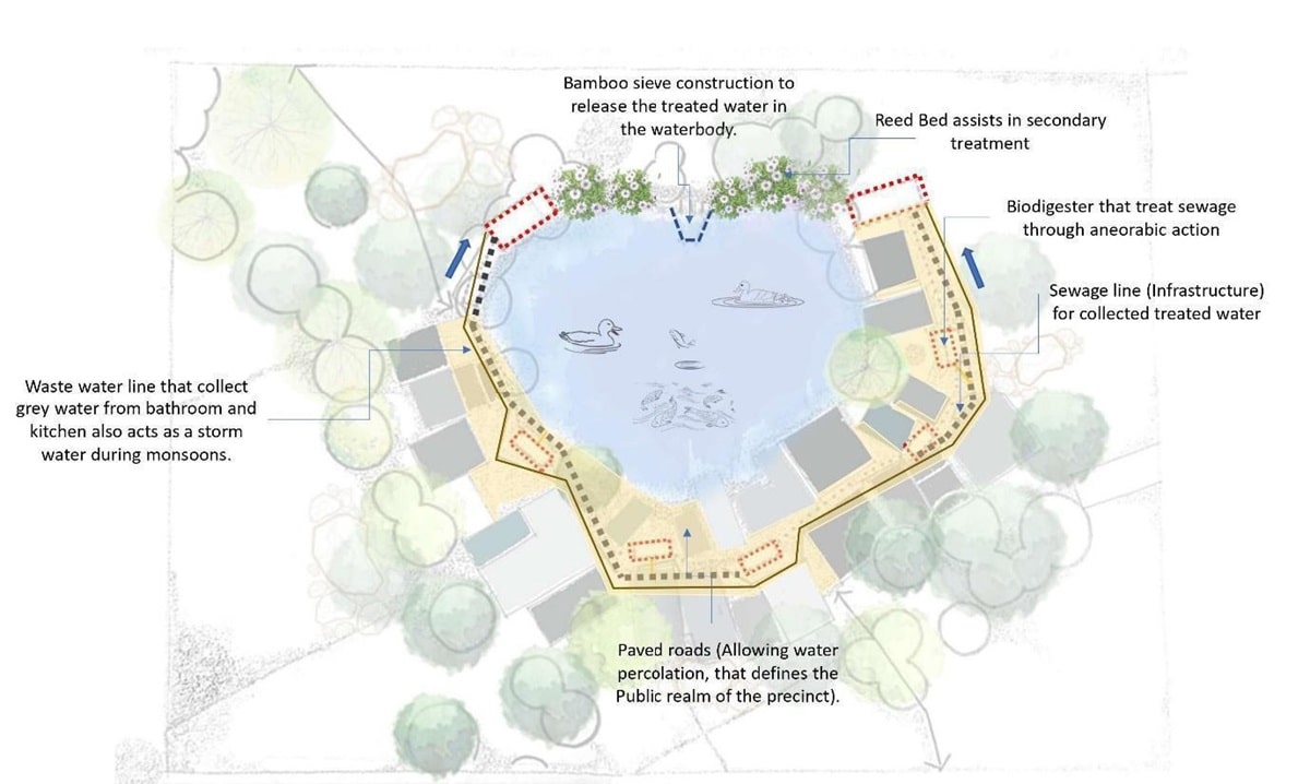
After researching nature-based sewage solutions in India, we aim to build a treatment system for vulnerable settlements. Currently, untreated sewage flows directly into nearby water bodies, harming biodiversity and causing microclimate changes. The team plan involves using bio-digesters for anaerobic sewage treatment, followed by secondary treatment in reed beds. The below plan shows the sewage, wastewater, and public space intervention with a typical settlement.
Furthermore, the plan demonstrates how treated sewage, rich in sunlight-activated bacteria, can contribute to beneficial algae growth, serving as an alternative to traditional fish feed. When this treated sewage flows into nearby water bodies, it acts as a tertiary treatment. In this natural setting, bacteria thrive in the presence of sunlight, and fish benefit from the excess nutrients, ultimately increasing available dissolved oxygen. This symbiotic relationship promotes a balanced and thriving ecosystem. The project plans to create women’s cooperatives in settlements to engage in fish rearing and duck breeding, harnessing this phenomenon. This approach mitigates climate change impacts and enhances community resilience over time.
Rural Mumbai Metropolitan Region villages can tap into Mahatma Gandhi NREGA funds once the projects’ positive impact on livelihoods is evident. Municipalities can allocate funds from their infrastructure budgets in urban areas, provided they recognize the benefits of choosing nature-based solutions over traditional concrete infrastructure.
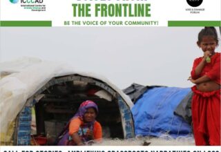
This story has been co-created with the support from ICCCAD, UNDP, and SEFFA, in the framework of the UNDP-managed Adaptation Fund Climate Innovation Accelerator (AFCIA). The UNDP AFCIA programme counts on financial contributions from the Adaptation Fund and the European Union and has awarded 44 micro and small grants to locally-led organizations across 33 countries worldwide, accelerating their innovative solutions to build resilience in the most vulnerable communities.
UNDP-AFCIA, is one of the funding windows anchored under the Adaptation Innovation Marketplace (AIM), a multi-stakeholder strategic platform that promotes scaled-up adaptation at the local level, launched by UNDP Administrator Achim Steiner at the Climate Adaptation Summit in January 2021.
Authors: Sheela Patel, Aneerudha Paul, Abhijit Ekbote, Maria Lobo, Bindiya Waghela, Pracheta Sawardekar